


Posted on September 22, 2016
During the past few months, the Centre of Geoinformation Science (CGIS) hosted three events to introduce school learners of various ages and backgrounds to geoinformatics. Geoinformatics is still a fairly young science and unknown to the general public. Thus, events like these are critical to introduce the geoinformatics to the school learners and inspire them to be passionate about mapping.
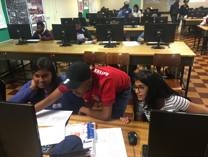
The first event took place on 16 June with Gr. 6 to 8 learners from Leeuewenhof Academy. The event was part of the YouthMappers initiative and arranged to celebrate the National Youth Day in South Africa. A total of 55 learners participated in two events; 1) map a building on campus using ClassiCube, and 2) participate in the Humanitarian OpenStreetMap Task (HOT) mapping dwellings in Mozambique for USAID. This event ran concurrently with another YouthMappers' event hosted by the Texas Tech University. For both of the mapping events (i.e. at UP and Texas Tech), approximately 15 000 edits were made on this task (http://goo.gl/qst7Vu).
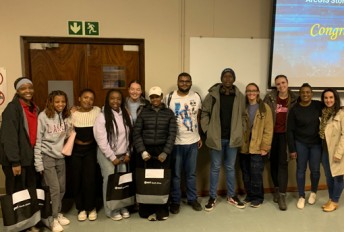
The second event on 20 August was intended for school learners interested in studying geoinformatics. Various schools from around Gauteng were invited and 43 learners attended the event. The majority of learners were from various schools in Mamelodi, City of Tshwane, and even a couple of learners from KwaZulu-Natal and Limpopo attended the event. The day started with various short talks by UP staff members, current students and a professional from the industry that provided insight into what to expect after your degree. This was followed by a scavenger hunt during which the learners collected data on campus, and thereafter they used this data to create a map. This was repeated on 9 September with the TUKS Sport School’s Gr 11 geography students. The aim of this event was to provide the learners with some hands-on experience with geoinformatics.
The feedback received from all three events and the students that assisted during the events were extremely positive. All three events were extremely successful in promoting the potential of geoinformatics as a future career.
CGIS would like to thank GISSA (Geo-Information Society of South Africa) for sponsorships transportation and lunch for the learners, and Esri South Africa for sponsoring prizes for the events. Lastly, we would like to express our gratitude to all the students that assisted with these events.


Copyright © University of Pretoria 2025. All rights reserved.
 Virtual Campus
Get Social With Us
Download the UP Mobile App